In the shadow of the Cascades, the Chuckanut Formation rises above Whatcom County’s lowlands and lies as far as 20,000 feet below. This peculiar rock formed during the Eocene epoch—34-55 million years ago—when ancient streams carried sediments (sand, silt, and clay) into floodplains. These sediments solidified and rose as earthquakes transformed the low-lying plains into the Chuckanut Mountains and hills we see today.
The Chuckanut Formation extends into British Columbia, Skagit, and Snohomish Counties. Nearby Huntingdon, Swauk, Roslyn, Chumstick, and Manastash Formations are closely related. The exact meaning of the Coast Salish word “Chuckanut” is disputed, but it evidently refers to Chuckanut Bay for its long tide and narrow entrance. From this bay originated the Chuckanut sandstone that has been built into historic Bellingham structures and throughout the Sound, marvelous in nature and architecture alike.
Natural History
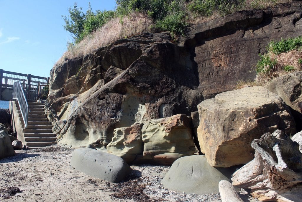
The Chuckanut Formation displays remarkable physical features. Sandstone on Whatcom County shores undergoes honeycomb weathering: the formation of “tafoni,” pockets and holes that look like honeycomb. Tafoni form when minerals come loose from the stone, expanding spaces between grains. Erosion and weathering result from physical processes such as waves and wind striking sediments against the stone. They also result from chemical processes, as when combined water and carbon dioxide weaken minerals’ chemical bonds.
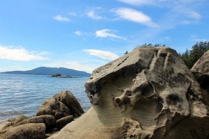
The Chuckanut Formation contains eons of fossilized subtropical plants. These include ancestors of Whatcom County’s present-day alders, sycamores, horsetails, and ferns. Fossilized palm fronds found here predate the present-day palmetto native only to the southeastern United States. Animal fossils are significantly rarer but include ancestors of herons, geese, and other shorebirds. Visitors to Western Washington University’s Geology Department can view local fossils of mammal, bird, and reptile footprints in Chuckanut sandstone.
Whatcom County tourists and locals enjoy finding Chuckanut sandstone high above and below sea level. The Chuckanut mountains, Chuckanut Drive, and Galbraith Mountain feature impressive cliffs. At Larrabee State Park, Wildcat and Teddy Bear Coves, Chuckanut Bay, and Clayton Beach, sandstone shorelines exhibit honeycomb weathering and tidepools. In Bellingham, the sandstone outcrop behind Mount Baker Theatre, tunnel on Sehome Hill, and walls at Boulevard Park are popular attractions.
Chuckanut Sandstone in Human History
The Chuckanut Formation has developed pockets of coal over eons of plants decomposing in peat bogs and swamps. Local Coast Salish tribes had known about the region’s coal since before settlers found it in upturned tree roots. Bellingham (originally four towns) hosted three mining operations: Pattle Mine under present-day Fairhaven in 1851, Sehome Mine under present-day downtown from 1853 to 1878, and Bellingham Coal Mine under present-day Birchwood from 1918 to 1955.
Early settler Henry Roeder established Chuckanut Stone Quarry near Teddy Bear Cove in 1856, shipping sandstone building blocks by schooner over Chuckanut Bay. It would become Roth Stone Quarry after Charles Roth married his daughter, early historian Lottie Roeder Roth, and took the reins. During the 1880s railroad boom, the quarry transported sandstone by rail and barge to Seattle, Tacoma, Olympia, Port Townsend, and Portland. As a member of the State Legislature, Roth provided stone for most early government buildings.
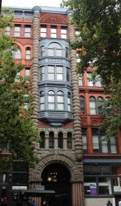
Roth Stone Quarry supplied Chuckanut sandstone to rebuild Seattle and San Francisco after their devastating fires in 1889 and 1906 respectively. Seattle’s Pioneer Square includes many buildings with sandstone trim, most famously the Pioneer Building.
Bellingham’s Sandstone Buildings
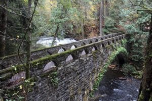
Most towering Chuckanut sandstone buildings from the quarry’s heyday have disappeared. Bearing an onion-domed clock tower, the 1891 Lighthouse Block on Cornwall and Holly hosted banks and offices until demolition in 1959. The Romanesque-style Sunset Block on East Holly and State hosted banks, saloons, offices, and theaters from 1890 to 1971. Tenants of Bellingham’s oldest extant building, T.G. Richards and Company Store, moved into a now-demolished sandstone courthouse on G Street in 1891. The 1891 Pike Block gained new life after burning in 1939: the Works Progress Administration built Whatcom Falls Park’s bridge from its salvaged sandstone arches.
Two imposing sandstone strongholds remain in Bellingham: Lottie Roth Block and Bellingham Armory.
Named for Lottie Roth, the 1890 Holly Street building uses original Roth Quarry sandstone. Charles Roth commissioned Elmer H. Fisher, architect of Seattle’s Richardsonian Romanesque sandstone buildings. The commercial block originally included four divided storefront windows and has housed apartments since 1918.
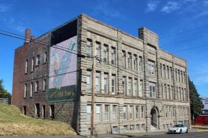
On North State Street, the 1910 Bellingham Armory attests to National Guard history. This castellated structure hosted training and military balls until World War II’s end, became a popular roller rink from 1953 to 1989, and commercial use in the present.
Many more Bellingham buildings sport Chuckanut sandstone trim. The historic Roeder Home, which served the family since 1908, uses Chuckanut sandstone from the quarry. The Daylight Building, Morse Hardware, Poplar Terrace Apartments, and Whatcom Museum are among several sandstone-trimmed buildings downtown. In Fairhaven, visitors can see Chuckanut sandstone on the Knights of Pythias, Waldron Block, and Fairhaven Library buildings.
Standing tall and proud, Bellingham’s sandstone buildings are only the latest cornerstone in a history as old as the hills.
"and" - Google News
June 25, 2021 at 09:01PM
https://ift.tt/3xOpx3m
Chuckanut Sandstone: The Bedrock of Whatcom County Geology and Architecture - whatcomtalk.com
"and" - Google News
https://ift.tt/35sHtDV
https://ift.tt/2ycZSIP
And
Bagikan Berita Ini


0 Response to "Chuckanut Sandstone: The Bedrock of Whatcom County Geology and Architecture - whatcomtalk.com"
Post a Comment